

2021 Version
By Randy Swart
With a lot of help from members of the Arlington Historical Society; Arlington historian Sara Collins; and Carol Nation, editor and graphic design artist.
This is a 26 mile self-guided tour with 13 stops. It takes most riders at least four hours, including the stops. If it seems too long, you can break it into two or more parts. (The Bluemont Trail cuts across the center.) There are a few good hills, but they can be walked, and the rest is flat to rolling. The total elevation gain is 568 feet.
The tour is best done on a weekend (for bikers or hikers) to include a visit to the Arlington Historical Museum, where we start and end. The museum is open free on Saturday and Sunday from 1:00-4:00pm.
You will need a u-lock for your bike at Arlington Cemetery and the Abingdon Ruins.
Please: Even though this is a fun outing, wear a helmet! Arlington and Falls Church ordinances require one for riders under the age of 15.
Before Leaving
Watch for other trail users on our well-used trails, and keep to the right of the center line. Alert pedestrians when you are about to pass from behind them with “bicycle passing on your left” or something similar. If you tour in a group, ride in single file. As in any urban area, lock up your bike whenever you leave it. Your shoes should be comfortable for walking.
In addition to this map and guide, a good street map (such as the Arlington County Bikeway Map and Guide available free from the county will be useful. You can download the map in .pdf format or get a free printed paper map. A compass might help prevent confusion at some spots. The low-stress route was chosen to minimize traffic and hills. If it seems too squiggly, you can use more direct routes on main streets if you do not mind riding in traffic. If you get lost, just ask someone for directions–Arlingtonians are friendly and will gladly help you.
**Look for this symbol** to identify the five designated Historic Districts on the tour. The County Web site lists all of Arlington’s Historic Districts and describes the work of the Historical Affairs and Landmark Review Board in preserving Arlington’s heritage.
Start!
The tour starts from the parking lot of the Arlington Historical Museum. Directions are on the Museum’s web page.

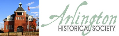
The museum is in the old Hume School, a red brick building built in 1891 at 1805 S. Arlington Ridge Rd. If the museum is open it is worth a visit. Please do not wear shoes with exposed steel cycling cleats in the museum to protect the wood floors. Linger here as long as you wish to see the local history exhibits. There are restrooms. The museum is staffed and maintained by Arlington Historical Society volunteers. Be sure to sign the guest book when you enter.
Native American Period
Arlington’s first residents whose history we know were Native American Indians, whose history here may date back 12,000 years. Various nomadic clans eventually established villages here, raising some crops and quarrying stone along Four Mile Run. The name they gave to this area was Nameroughquena – “The Place Where Fish Are Caught.” One of the few native American names that endures in this area is Anacostia, the English colonists Latinized version of Necostin. Although part of the Algonquian Nation, the Native Americans here were apparently not affiliated with Chief Powhatan’s confederation, since they were willing to deal with Captain John Smith and his men when Smith visited here in 1608. The tribes who inhabited this area departed about the time the English began to settle in Virginia, squeezed westward by the colonists coming up the Potomac River from the south and war-like Susquehannocks moving down from the north. There is no “Native American” stop on this tour.
Directions: Prom the museum parking lot, turn right and travel along South Arlington Ridge Road. Just after the intersection of South Lynn Street, you will see on your right a small stone tower. It was once part of the Little Tea House, fondly remembered by long-time Arlington residents as a pleasant place to dine and enjoy the view of Washington in pre-high rise days. Pause at the end of Arlington Ridge Road to enjoy the view from Prospect Hill.
Prospect Hill

James Roach built a house here in the 1800s that was destroyed during the Civil War. Roach’s quarrying company produced stone for such notable works as the railroad that followed what we know today as the Washington & Old Dominion trail. Quarrying changed the face of the Arlington side of the Potomac River, severely reducing the cliffs that once made Spout Run spout. Arlington Ridge Road once ran beyond here and was the main high road from Georgetown to Alexandria. The Pentagon was built in 1941. Shirley Highway (I-395) followed in the 1950s. The high spires of the Air Force Monument were added in 2006. On a clear day you can see many of Washington’s monuments and landmarks from here.
Directions: The tour will now continue down South Nash Street for the longest uninterrupted riding of the day. Turn left onto South Army-Navy Drive for the long, gentle, downhill ride parallel to 1-395. Turn left on 28th Street South, then right on South Meade Street. At South Glebe Road, cross at the light and take the sidewalk on the other side, turning right. It crosses a stream, then bear left onto the trail. At a high railing, turn sharply left to stay on the trail as it crosses under West Glebe Road and I-395, emerging at Shirlington Road near the Village at Shirlington. Turn right onto the sidewalk, then left at the light to the start of the W&OD trail. Follow the trail.
As you cross Columbia Pike you will pass on your left the historic markers for Barcroft and for the site of the old Arlington Mill, built here by George Washington Parke Custis and destroyed by Union troops during the Civil War. The Mill was purchased after the war and restored by Dr. John Barcroft who, before the war, had built his first mill farther out Columbia Pike near the lake also named for him.

In 1903 you would have been on railroad tracks and would see the mill on the left on the other side of the stream. It was below the current Columbia Pike but above the old road whose bridge is visible beyond the mill, now called 10th St South. The photo shows the north side of the mill with the largest mill wheel on the east coast. It sat on the foundations of the building that now houses Jim’s Automotive. After you cross Columbia Pike, on your right would have been Haring’s Store, the hub of the Barcroft neighborhood and its post office, replaced by the 1950’s shopping center. There is a water fountain on your left, and the park has a training loop trail for beginning riders.

Continue on the trail. Here you are passing the fall line of Four Mile Run, marking the spot where two geographic regions meet: the Tidewater to the east and the Piedmont. The same fall line extends up and down the East Coast of the United States. In the Potomac River it is marked by Great Falls. Here on Four Mile Run the scale is reduced to some little riffles. After a half-mile, you will pass the observation deck for Sparrow Pond, then about two hundred yards later when you see the bathroom facility below on the left, take the trail down there and then the trail that goes behind the bathrooms back to the parking lot, dog area, and picnic area you just passed. Look to your left for the curved stone wall protecting the survey marker.
Washington’s Survey Tree
George Washington owned nearly 1,200 acres of land in Arlington. This marker is located where a giant oak once stood. It was a surveyors marker here where Long Branch meets Four Mile Run. Many deeds in the area reference it, including George Washington’s forest property that began about 300 yards south along Four Mile Run.

The marker was erected by the Glencarlyn Co-Operative Association in the early 1900s and some years later the Daughters of the American Revolution built an iron bar cage to protect it. Periodic floods brought torrential waters and sometimes heavy timbers down the stream. The battered cage was replaced with the current stone wall by Arlington County in 2012. The almost illegible inscription on the stone was: “On the spot where this monument now stands at the juncture of Four Mile Run and the upper reach of Long Branch in Glencarlyn Park, stood a great oak tree bearing a survey mark which was put there by General Washington.” The section of the oak below is on exhibit in the Glencarlyn Public Library up the hill. We will pass that soon on the ride.
Directions: Continue through the parking lot and picnic area along Long Branch, climbing the very steep hill at the end of the picnic area. Watch for cars on the hill, where sight lines are only a few feet and bikes tend to wobble. At the top you emerge into Glencarlyn neighborhood. Take 4th Street South, riding two blocks to the Glencarlyn community house just beyond South Kensington Street.
Glencarlyn
One of Arlington’s communities was developed by George Curtis and Samuel Burdette in the late 1800s. It was originally named Carlin Springs, but the Post Office insisted that it be renamed in 1896 because there was another town in Virginia with the same name. Thus the name was changed to Glencarlyn, with a new spelling of the Carlin name. (There is still occasional confusion in Arlington about the spelling of the Carlin name.) Carlin Hall was built in 1892 as a community center (it is Arlington’s oldest community center) and has also been used as a school.

The old Ball-Carlin Cemetery is located between the community house and the brick building that houses the Glencarlyn branch library. The large and handsome house across the street at the corner of 3rd Street South and South Kensington Street was built farther over on Carlin Springs Road and moved here when construction threatened it some years ago. To its left on the north side of 3rd Street South is a beautiful Victorian house built here by Samuel Burdett, one of the founders of Glencarlyn.

Around the corner on the south side of 3rd Street South is our next destination, the John Ball House at 5620 3rd St. S.
John Ball House
This house–now known as the Ball-Sellers House–Arlington’s oldest residence, was built by John Ball in the 1750s and was purchased by William Carlin in 1772. Like the Arlington Historical Museum, it is owned and operated by the Arlington Historical Society and is now named, the Ball-Sellers House

John Ball was one of Arlington’s original colonial settlers. William Carlin was George Washington’s tailor. The house is a landmark of pioneer Arlington and a rare example of the homes where people of the time in ordinary occupations lived. The original house is the lower section to the left. It was a log cabin that was later covered with siding. It faces away from 3rd Street. The two-story portion to the right was added about 1885. On the east wall (the one facing left) you can see a cutout showing the original logs. The original roof was of clapboard construction rather than shingles or shakes. It was later covered by adding a completely separate second roof above it. The Sellers family donated the house to the Arlington Historical Society in 1975. It may be possible to see the interior, so check the link for hours. There is no admission fee, but a donation is appreciated. The house is also open for Historical Society activities at various times during the year. If you did not see the inside, you can ask for the date of the next open house when you return to the museum.
Directions: The next stop is at Carlin’s actual springs. (Carlin Springs Road is named for them.) Proceed down 3rd Street South to turn left at South Jefferson Street. At the bottom of the hill on the right is a narrow path back down into Four Mile Run Park. It is very steep at the top and you may want to walk the first few feet, but the slope improves and it widens, continuing downhill. At the bottom to the right you will see a small shelter and a picnic table. Turn right off the trail there onto the dirt path and walk across the little wooden bridge back into the trees to look for two small (3 feet by 2 feet) stone spring boxes set into the hillside ahead. Those are Carlin’s Springs. In 2003 a tree fell over one of the spring boxes, and is still there. The boxes are beginning to deteriorate.
Carlin Springs

The beautiful picnic spot where you are standing and the area lying immediately downstream were developed by the Carlin family into a picnic park known as Carlin’s Springs. The railroad that ran through here (the Alexandria, Loudoun and Hampshire, remembered today as the Washington & Old Dominion or W&OD) stopped at this point to pick up water for the steam engines. The Carlin family developed an amusement park here in 1872 where Washington residents came by train for Sunday picnics. Carlin’s Springs remained a park until developers bought the land during the building of Glencarlyn community. The old buildings were demolished in 1893 but the land was retained as a natural park until acquired by Arlington County in 1943.
Directions: Backtrack past the picnic shelter and turn right when you get to the trail to regain the Washington & Old Dominion Trail. Turn left onto the W&OD. You will cross under Arlington Boulevard, and now street names will be designated North instead of South. The trail dips to cross under Carlin Springs Road. If you wish, take the dirt path to the street before crossing under, to climb the steep hill to the right to see Mary Carlin’s house, a nicely preserved log cabin easily identified by the historic marker.

The trail continues past sports fields and a red caboose from the Southern Railroad that marks the spot known as Bluemont Junction where once the W&OD met another rail line from Rosslyn and a trolley line.
You can stop at the caboose for some rail history on summer weekends. Further along are tennis courts (restrooms, vending machines for soft drinks), just before you come to Wilson Boulevard. Cross under Wilson and loop up to the left to the Wilson Boulevard sidewalk, crossing Four Mile Run on the bridge. At N. Lexington St, turn right into the Bon Air parking lot.
To your left is the Bon Air Memorial Rose Garden, a notable garden showcase. Turn left into the rose garden parking lot. This is a great lunch spot, with picnic tables between the rose garden and Four Mile Run and restrooms in the brick building beyond the parking lot.

To your right, in the springtime you may see magnificent azaleas in bloom and a small wildflower garden. (If you need to buy lunch, there are several eateries nearby, both east and west on Wilson Boulevard as you emerge from the rose garden parking lot. Unfortunately they are up steep hills.) The rose garden is at its best in mid-June, but is worth a visit at any time if only to see the famous names of those who donated the various bushes around the center circle. It has over 3,000 rose plants of every type and some very interesting hybrids. If you are there for the weekly pruning you may find roses in the trash cans to take home. There are other picnic spots farther along the route as it follows the W&OD Trail.
Bon Air and Arlington’s Communities
At the rose garden, you are in the neighborhood known as Bon Air. Bon Air was an early commuter village, with a streetcar stop near here. In 1924 there were 99 streetcar stops in Arlington on six lines. The streetcars were the County’s first means of transport that did not bog down in the spring mud, and they opened large residential areas to Washington workers. The Metro line that today runs out Fairfax Drive to Vienna follows the same route used by the streetcar line to East Falls Church, and Metro has used some of the original trolley stop names. The caboose you saw at Bluemont Junction marks the area where the Bluemont Line met the railroad tracks of the W&OD. Arlington’s small independent communities like Bon Air had their own schools, churches and libraries. The County was at that time still largely rural, with small residential communities dotted across it. Population growth did not take off until the 1930s. Each small community had its own street names, and the Post Office Department refused to establish a central post office for the County until something was done about the streets or avenues with the same name, including 11 Washingtons, 10 Arlingtons and 9 Virginias. The County renamed its streets in 1935 with a uniform system of numbered streets and alphabetized names, attempting to impose logic and continuity on this patchwork quilt. (The Civic Federation’s page on “Finding Streets in Arlington” explains the system. People who read it are seldom lost here.)

Directions: Return on the Wilson Blvd. sidewalk back to regain the W&OD Trail. Go straight, and you will soon be alongside 1-66. You will pass a wildflower area, some nice willows and Virginia Fringe Trees. At the top of the hill is the historic Marker for Brandymore Castle, a rock formation that once had Four Mile Run flowing as a “moat” around its base. The construction of I-66 changed all that, and the stream now flows in culverts and floodwater retention caverns under the highway. Watch out for a right-angle turn at the bottom of the first hill, and another turn to the right at the basketball court. 2020 detour not on the map: another right turn takes you on a trail to cross North Sycamore Street, then for one block up 19th Street North. Turn left at North Tuckahoe Street, then right onto 18th Street North. Two blocks later, turn right onto North Van Buren Street. To your left you will see a small boundary stone with a two-foot-square iron fence around it. It sits in Benjamin Banneker Park.

Take a look at the stone and its signs, for you will soon be hearing more about it! Turn around and go up North Van Buren Street two blocks to turn left on 19th Road North. Turn right onto the trail spur alongside North Vanderpool St. Turn left onto the W&OD Trail to cross Lee Highway, continuing west. .Cross Little Falls Road. At Great Falls Street leave the trail and turn right, pass through the traffic light and turn right at North Dorchester Road. Turn left on North Meridian Street. At the end of the block is a park on the left with a sign that reads Andrew Ellicott Park at the West Cornerstone. Lean your bike against the fence and walk down the path to the stone with the fence around it.
The West Cornerstone: Andrew Ellicott Park

A look at the map shows that this is the spot where Arlington, Falls Church and Fairfax all meet at one point. Their boundaries are indicated here by the lines of stones along the ground. This cornerstone marks the western corner of the 10-mile-square capital laid out by Andrew Ellicott with the expert assistance of Benjamin Banneker after the great debate on the location of the nation’s new capital was solved by allowing both Virginia and Maryland to cede patches of ground for a capital district. The Virginia section of the District was ceded to the District of Columbia in 1801 and became Alexandria County of the District of Columbia. After much complaining by the neglected residents it was finally retroceded to the State of Virginia in 1847, still known as Alexandria County. The county seat and courthouse were located in the City of Alexandria. A new courthouse was relocated in its present location in 1898. The name was changed to Arlington County in 1920 to improve recognition and to avoid confusion between the City and County of Alexandria. In 1932 Arlington County became well known nationwide as the originator of the county manager form of government, still known in political science textbooks as The Arlington Plan.
There were stones similar to this one at each of the four corners of the District, and nine smaller stones on each boundary marked the mile points between. Many of the smaller stones have been lost or displaced over the years, but 32 have been preserved through the efforts of the Daughters of the American Revolution, who built the fence protecting this stone and the others that remain (including the one you just saw one mile from this spot In Banneker Park. That was Southwest Stone #9). The inscription on this stone wraps around two sides, and once read “Jurisdiction of the United States.” The date on the back is 1791.
Directions: Turn back along Meridian Street to North Lincoln Avenue, turning left. (Watch for traffic coming from the right over the hill.) Lincoln widens and becomes Fairfax Drive. Turn left at N. Westmoreland/N. Winchester Street and cross under 1-66. Turn right into 28th Street North. It becomes Little Falls for a time, then crosses Sycamore and reverts to 28th. Turn right on North Powhatan Street. Cross Lee Highway–carefully–and go on to the end of the block, where you will see that 2230 N. Powhatan St. on the right is grander than its neighbors. It is the mansion known as Maple Shade.
Maple Shade
This house was built in 1851 by Captain Henry W. Febrey, just before the Civil War.

During the Hall’s Hill skirmish, a part of the Battle of Munson Hill, the house was damaged by Union cannon. The damage is still visible inside the house. It offers a reminder that the Civil War was hard on Arlington, with at least 10,000 Union troops stationed here among a population of only 1,486. Thousands of acres of forests were cut, lest they harbor rebels. Mills, houses and other buildings were destroyed, many dismantled by the invaders for building materials. Productive farmland was reduced substantially. Forts were built, new roads cut and trenches dug. And finally, Arlington Cemetery was created from the estate seized from the Custis and Lee families. The war left its mark on Arlington for many years and still shapes some elements of our environment.
Directions: Down the little hill at the end of North Powhatan Street is a narrow gravel path you may want to walk because the gravel can be difficult. The path emerges on 22nd Street North. Turn left on 22nd, then right onto North Lexington. Lexington becomes 16th Street North. Follow 16th for about a mile to North Abingdon Street, turning left. Abingdon becomes N. Culpepper, and in a very short block you reach the intersection with 17th Road North. Stop and look to your left and you will see the Hall’s Hill Wall.
Halls Hill – High View Park Mural

The mural on the wall behind the tennis court is dedicated to the traditionally African American neighborhood of Halls Hill – High View Park. Roderick Turner and youth from the Community Center painted it in 1995. Mr. Turner rode his bicycle every day to the site. He is restoring the mural in the 2021 photo above. The left panel shows youth basketball and football players. The center panel honors John Mercer Langston (1829 – 1897), an African American abolitionist, attorney, educator, activist, and U.S. Minister to Haiti who was the first dean of the law school at Howard University and the first president of what is now Virginia State University, a historically black college. The final panel shows the neighborhood fire station, Arlington’s first African American fire station, established in 1918.
Directions: Return to Culpeper St and turn left down a VERY STEEP HILL – CAUTION. Stop at 17th Road North. On your right and you will see the Hall’s Hill Wall.
Hall’s Hill Wall

The 7 foot cinderblock wall you see is among the last remaining pieces of a wall constructed in the 1930’s to separate the black neighborhood known as Hall’s Hill/High View Park (to the north, on your right) from a new white development known as Woodlawn Village (now Waycroft-Woodlawn). Various materials including wood and cinderblock were used for the wall, and the only connecting street was N. Edison until Arlington County removed a large section of the wall in 1966 to connect N. Culpeper to N. Abingdon on the other side. This section of wall is a concrete reminder that Arlington was completely segregated by race–schools, churches, theaters, transit, neighborhoods and more.
Directions: Look to your left for a curb cut on the other side of N. Culpeper leading onto a narrow paved trail. Take that trail along the school yard, cross North Glebe Road at the light at 18th Street North, then turn left on 17th, and on the left you will see the historic marker for The Glebe House at 4527 17th Street North.
The Glebe
This house is thought to stand on the foundation of the original Glebe house built here in 1775. It is now a private home, so please do not go inside the fence.

A glebe was a farm provided to the rector of a parish of the Church of England as a part of his salary. The preacher either farmed the land himself or more likely leased it to a tenant farmer. This glebe was the property of Fairfax Parish, including Christ Church in Alexandria and the Falls Church in the town of that name. After the American Revolution, the Commonwealth of Virginia passed a law providing for the disestablishment of the Church of England in the state, and expropriated all glebes in the state in 1802. The courts held that this glebe was at the time not legally in Virginia, since the land where you are standing had been ceded to the District of Columbia. Virginia was therefore not allowed to seize this glebe.

The original house burned down in 1808, and Christ Church eventually sold the glebe farm in 1815 to buy a rectory in Alexandria. The house was rebuilt as a hunting lodge in 1820. At that time it consisted of just the rectangular section to the right. The Octagon Wing, now the house’s main architectural feature, was added around 1850, perhaps by Clark Mills, a sculptor of the time. The teak eagle on the roof was added by Caleb Cushing. It was presented to him by the people of Spain in the 1870’s in appreciation of his service as U.S. Ambassador there.
After many years as a private home, the Glebe was converted in the 1980’s to house the offices of the National Genealogical Society, but in 2002 it was put up for sale, and bought by the Ortmans family. They restored the interior, updated the kitchen and added to the back, moving in during 2006. They also gave an easement to the Northern Virginia Conservation Trust preventing any owner from demolishing the house and subdividing the property. The townhouses to the rear had already been built on former Glebe House grounds, and of course the entire surrounding neighborhood had been developed on the rector’s former farmland.
Directions: Turn your back on the Glebe and ride down North Wakefield Street, jogging left and right to stay on Wakefield until you reach the end where it meets the Martha Custis Trail, named for George Washington’s wife. Left on the Custis Trail for some nice riding, passing the neighborhood sign that lets you know you are passing Maywood, the first neighborhood in Arlington designated as an historic district. You could take a detour to explore its quiet streets and historic homes. Much further along, leave the trail to turn right on N. Scott Street. Scott becomes Key Boulevard, then turn right on Quinn Street and take the first left on 18th Street N. then right at mid-block onto a Rosslyn Highlands Park trail that takes you to N. Pierce Street. Follow Pierce to the bottom of the hill and a T intersection marked Fairfax Drive that is actually the service road for Arlington Boulevard. Turn left and continue until you reach Fort Myer Drive and Dark Star Park.
Dark Star Park
This park, with its whimsical sculptures, is an example of Arlington’s earliest use of public art. The late Nancy Holt designed the park and the sculptures. The whimsy softens the edges of the high rise canyons of the Rosslyn district. In the center of the traffic island there are outlines on the ground beside the poles and balls. On August 1 at 9:31 AM the shadows all line up within the outlines: Stonehenge in Arlington.

Large crowds can gather on that day. The time commemorates the signing of the Rosslyn Farm deed by the Ross family. If you can’t be there, you can find an interesting film about Dark Star Park featuring Nancy Holt in the Arlington Central Library.
Directions: Take Fort Myer Drive over the Arlington Boulevard bridge and it becomes Meade Street. Pass the Iwo Jima Memorial on your left and further over the Netherlands Carillon. At the T intersection turn left and follow the trail along the cemetery wall on your right around to the Cemetery Administration building. Lock your bike and walk up the hill past the John F Kennedy memorial flame to Arlington House.
Arlington House
The County took its name from this estate in 1920 when it dropped the name Alexandria County to distinguish itself from Alexandria City.

The house was built by George Washington Parke Custis (known as “Washington” Custis), a grandson of Martha Custis Washington. Washington Custis was adopted by George and Martha Washington after his own father’s death at Yorktown. The house was located on the northern third of the Abingdon Estate that Washington Custis had inherited. (The ruins of Abingdon House will be our next stop.) Arlington House was begun in 1802, with the north wing finished in 1803 and the south wing finished one year later. Construction of the middle section was delayed for some years because upon the death of George Washington and the sale of his estate, Washington Custis decided to buy as much of the George Washington memorabilia as he could. So the Custis family lived here in the two wings for some years before the center part of the house was finished in 1817.
Washington Custis favored the name Mount Washington for this spot, but was persuaded to name it Arlington after the ancestral home of the Custis family south of here in Virginia, that in turn had probably been named for an English town called Arlington. In 1831 a young U.S. Army officer named Robert E. Lee married Washington Custis’ daughter, Mary Ann Randolph Custis, in this house. Lee came here to live with his family between his military assignments. When Washington Custis died in 1857, Lee took up residence here to set the estate straight. The Lees left the house in 1861 shortly after the Civil War began and the house was occupied by Union troops. (Later it was technically seized for non-payment of taxes that in fact Mrs. Lee had paid, but the payment was refused because she could not deliver it in person.)
After the Union forces were routed at the Battle of Bull Run and had fled back to Washington, some of the Union dead were buried here at the order of General Montgomery C. Meigs, who had lost his son at Bull Run and put the cemetery here to make the house uninhabitable for the Lees after the war. During the war, the plight of the freed slaves from southern states living in squalid refugee camp conditions in Washington led to the creation of Freedmen’s Village on the Arlington estate grounds. Many years after the war, the village was dismantled and its residents relocated. Some current residents of Arlington View neighborhood trace their families back to Freedmen’s Village.
The Potomac River bridges below you have always been important to Arlington’s development. The oldest was built where Chain Bridge now stands (far out of sight upstream from here to your left). It was built in 1797 by the merchants of Georgetown in their struggle to dominate the commerce of the area. The first bridge there was washed away several times by floods before replacement by a suspension bridge that hung from huge chains. The chains are long gone, but it is still known as Chain Bridge. The second bridge site was known as the Long Bridge, and was built in 1808 where the 14th Street Bridge is today, to your right. Next, the merchants of Alexandria, who were Georgetown’s chief rivals, lobbied successfully for the Aqueduct Bridge, built in the 1840s on the current site of Key Bridge (to your left) to carry the C&O canal in a raised channel across the Potomac and down to Alexandria. Memorial Bridge (directly in front of you) was built in 1932 as a memorial to the reuniting of North and South, the reason for the wide sidewalks and ornamental railing. The various other standard Interstate bridges were all built in the 1960s or even more recently.
Directions: Return to your bicycle. Get onto the wide sidewalk on the right and continue until you cross the Parkway ramp leading to Memorial Bridge. Turn right at the T immediately beyond the ramp crossing, cross another off-ramp, bear left where the trail sign points, cross the Parkway and turn right to ride on the trail down the river. Turn left at the sign that says Washington National Airport, and follow that trail through an underpass and on to the Bicycle Parking. Lock your bike and proceed on foot to the Abingdon Ruins, a round trip of .6 miles, or walk your bike, adding .6 to the cue sheet mileage from this point on. No bicycle riding is permitted in the garage. Follow the brown signs overhead to Abingdon, crossing the garage toward the airport terminals to the far wall, then turn right, climb or elevator up one level, and continue until you reach the walkway marked Abingdon Ruins. Walk up the slope to the historic marker and the fragments of old walls.
Abingdon Plantation

Abingdon plantation was owned for many years by the Alexander family, for whom Alexandria was named. John Parke Custis, Martha Washington’s son, purchased the plantation and moved his family to Abingdon in 1778. It was the birthplace of Nelly Custis. After her father’s death, George and Martha Washington raised Nelly and George Washington Parke Custis. Arlington plantation was carved out of the northern third of Abingdon. Abingdon survived Union occupation during the Civil War and the end of plantation life, but fell into disrepair until it burned in 1930. In 1938 National Airport was built, with the runways mostly on landfill, moving Abingdon back from the edge of the Potomac and eventually eliminating the spectacular view. The airport was about to replace the ruins with another parking lot when Arlington historian Eleanor Lee Templeman, then on her deathbed, raised the alarm in Richmond, forcing hearings on the historic significance of the ruins and leading to their preservation. There are some interesting historic placards to read on the site.
Directions: Retrace your steps to your bicycle, and return to the Mount Vernon Trail. Turn right toward DC, then after the first overpass take a left marked “Crystal City.” This trail loops under the Parkway to a tunnel that emerges at the fountain park in Crystal City. Turn left then immediately right onto 18th Street South. Follow 18th Street for five blocks to the entrance to Virginia Highlands Park on the left. Turn left into the park, then immediately right. A few yards further on, turn left onto the marked bike trail. Pass between two soccer fields, then at the steep little uphill make another left turn onto a much narrower trail that will take you a few yards to a right turn onto 16th Street South. Follow 16th Street to a right onto Kent Street South. Enter the parking lot, turn left, then take the second right to climb the hill through the parking lot up to its back entrance on S. Lynn Street. Turn left on S. Lynn. At the intersection of South Arlington Ridge Road you can cross onto the left sidewalk to avoid the busy Ridge Road traffic, or continue on Ridge Road using the miserably small striped area next to the curb as if it were a bike lane. Turn left into the parking lot of the Arlington Historical Museum.
That concludes your tour. We hope you enjoyed it!
If you found problems or have a comment please email Randy Swart.
- Here is a pdf version of the ride for printouts.
- Here is a pdf map of the ride.
- Here is a cue sheet of the ride.
The following file has not been updated yet for 2021 detours!
- Here is the Map My Ride map. It is a Google-based map with drilling down to see details, a profile of the hills and lots more.
History Bike Tour was last modified: January 129, 2021.
The Arlington Historical Society thanks Randy Swart for allowing us to post this permanently on the AHS website. Many thanks!